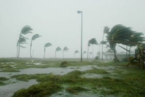
 Matthew is no longer a category 5 hurricane but still poses severe risk to lives.
At 11 p.m. on Friday, the U.S. National Hurricane Center announced that Matthew had strengthened from a Category 4 to a Category 5 hurricane over the Caribbean Sea. With maximum sustained winds up to 160 mph, Matthew had been the strongest hurricane in the Atlantic Basin since Hurricane Felix in 2007.
Less than six hours later, on Saturday, the meteorologists announced the hurricane had weakened and returned to a Category 4 of the five-step Saffir-Simpson scale of hurricane intensity.
From Dominique to St. Lucia and Barbados, Matthew brought wind gusts from 50 mph to 60 mph and heavy rain of up to 3 inches, producing landslides and flash flooding. The tropical storm killed a teenager in St. Vincent on Wednesday, the National Emergency Management Organisation announced.
By late Sunday or Monday, Matthew is expected to track over Jamaica and Haiti before threatening to hit eastern Cuba. Evan Thompson, director of Jamaica’s National Meteorological Service, said there could be 10 to 15 inches of total rainfall, with isolated maximum amounts of 25 inches and winds of 75 mph or greater are possible in Jamaica and Haiti. An emergency Parliament meeting to discuss storm preparations was called by Jamaica’s Prime Minister Andrew Holness on Friday and Jamaicans raced to the supermarkets to stock up on supplies.
It is still unclear whether Matthew will hit Florida, according to CNN Weather. However flights have been canceled and cruise ships itineraries changed.
